Short answer. They answer different questions. SunCalc shows where the sun is and when it rises and sets, anywhere, free. ShadeMap paints the shadows of buildings, trees and hills over a whole map, which is great for finding shade outdoors. Shadowmap shows sun and shadow on 3D buildings, free for today's date and paid for any other date and for its home and pro features. SunEarthTools gives sun tables and sun path charts. Flatwalk's sun tool counts the hours of direct sun on your own window, on your floor, month by month, free, but only for windows and with its best data in a list of cities.
Try it free: type your address, pick your floor and window, see your hours of sun
At a glance
| What it shows | Buildings, trees, hills | Any date | Price | Best for | |
|---|---|---|---|---|---|
| SunCalc | Sun position, sun path, sunrise and sunset, shadow length | None | Yes | ✓ FreeDonations optional | Photographers, solar, quick sun times anywhere |
| ShadeMap | Shadows over a whole map, sun exposure | Buildings, trees and terrain | Yes, says its site | No price shown for the map | Finding shade outdoors: parks, terraces, walks |
| Shadowmap | Sun and shadow on a 3D city, solar analysis | 3D buildings and terrain; trees and editing on paid plans | Paid (Explorer and up) | LimitedFree for today; from 2.50 a month | Home seekers, architects, solar pros |
| SunEarthTools | Sun position tables, sun path charts, sunrise calendars | An obstacle profile option | Yes | No price found; donation button | Tables, charts, sundials, PV payback |
| Flatwalk sun tool | Hours of direct sun on your window, by day and month | Buildings, trees and hills, best in listed cities | Yes | ✓ Free | Buying or renting a flat or house: one window, one floor |
Prices are as shown on each site's own page on 22 October 2026; Shadowmap's page as we read it showed the figures without a currency sign.
SunCalc (suncalc.org)
What it does. SunCalc "shows the movement of the sun and sunlight-phase for a certain day at a certain place". You drop a pin on a map, pick a date and slide the time. It draws the sun's path, the yearly band it moves in, and gives dawn, sunrise, the sun's highest point, sunset and dusk, the sun's height and direction, the shadow length of an object of a given height, and a section for solar panels.
Price. Free to use. Donations are optional.
Where it is better than Flatwalk. It works for any spot on Earth, instantly, with no data gaps. It has the astronomy detail photographers and solar people want: dawn and dusk times, azimuth and a section for solar panels. If you only need "where does the sun set from here in June", SunCalc is quicker.
Where it stops. It knows nothing about buildings or trees, so it cannot tell you whether the sun actually reaches your window. It had about 995,000 visits in September 2026 (Semrush estimate).
ShadeMap (shademap.app)
What it does. ShadeMap simulates "shadows cast by buildings, trees and terrain in 3D" over a map, so you can see at a glance where the shade falls in a whole neighbourhood. It also offers sun position, sun path, sun exposure and shadow accumulation maps, and it "works online" with nothing to install. A separate developer toolkit lets companies build it into their own apps.
Price. Its public pages we read showed no price for the map itself. The developer toolkit has plans called Learn (free on a test machine), Ship and Scale, without prices on the page.
Where it is better than Flatwalk. It shows shade everywhere at once, outdoors, including hills and trees, which is what you want for a shady park bench in a heatwave, a terrace for lunch or a sunny hiking route. Flatwalk measures windows only.
Where it stops. It shows where shade falls, not the hours of sun on one window on one floor, month by month. It had about 787,000 visits in September 2026 (Semrush estimate).
Shadowmap (shadowmap.org)
What it does. Shadowmap shows sunlight and shadow on a 3D model of the world, on the web and in apps (Android, and an iPhone app on the App Store). On the Studio plan you can upload your own 3D models.
Price. Free with no registration for the sun path, the compass and the time of the current day, with 3D buildings and terrain worldwide. Explorer (2.50 a month, billed yearly, 30 in total) adds any date and editing buildings and trees. Home (10 a month) adds a sunlight simulation over 365 days, floors drawn on facades, changing building heights, roofs and trees. Studio (60 a month) adds 3D solar analytics and your own 3D models.
Where it is better than Flatwalk. 3D buildings and terrain worldwide, your own architect's models and solar analysis of roofs and facades. For an architect or a solar professional it does far more.
Where it stops. Any date other than today, and the home features, are paid. It had about 431,000 visits in September 2026 (Semrush estimate).
SunEarthTools (sunearthtools.com)
What it does. A set of calculators: the sun's position for any place and time, sun path charts in polar or rectangular form, shadow length, a year of sunrise and sunset times, photovoltaic payback, a sundial designer, and map tools. The sun position page names an "Obstacle profile" option.
Price. We found no price or paid plan on its pages; there is a donation button.
Where it is better than Flatwalk. Printable tables and classic sun path charts, sunrise and sunset calendars for a whole year, and tools for solar payback and sundials. Flatwalk does none of these.
Where it stops. It is a calculator, not a picture of your street. It had about 207,000 visits in September 2026 (Semrush estimate).
Flatwalk's sun tool (flatwalk.app/sun)
What it does. You type an address, pick your house or flat and your floor, put your windows on the wall in 3D and see the hours of direct sun on each window on any day of the year. It counts the buildings, trees and hills in the way and names them ("What takes your sun"). It shows 12 month bars ("Hours a day, by month"), the hours over a year, a Sun score against the same window facing due south with nothing in front, and, with Typical weather on, the hours with the usual clouds. You can add a building that is not built yet, or a tree, and read the change. Copy link saves the whole view.
Price. Free. The address you type goes to a map search service to find the place; the page says "We store nothing".
Where it is better than the others. None of the four tools above answers "how many hours of sun reach this window, on this floor, by month", and none lets you add a planned building and read the hours each window loses. Flatwalk does both, free.
Where it stops. Windows only: not a garden, terrace or roof. Building heights are measured only in London, Manchester, Cardiff, Edinburgh, Glasgow, Berlin, Munich, Hamburg, Warsaw, Kraków, Wrocław, New York City, Chicago, Toronto, Vancouver and Montreal; elsewhere they are estimated, and outside the areas it covers in the UK, Germany, Poland, Lithuania, the US and Canada it is slower and treats the ground as flat.
Which one for which job
- "When does the sun rise, set, or stand highest here?" SunCalc or SunEarthTools.
- "Where is the shade right now in this park or on this street?" ShadeMap.
- "Show me the sun on a 3D city for any date, or analyse a roof for solar." Shadowmap (paid for those).
- "How many hours of sun will my window get, on my floor, in December?" Flatwalk's sun tool.
- "What will the planned block across the road do to my sun?" Flatwalk's sun tool (Add a building).
Check your own window with Flatwalk, step by step
- Type your address under "See the sun at your window".
- Find your building on the satellite map (the one under the pin is green; tap another if it is wrong). Choose A whole house or A flat, and set your floor.
- Put your window on the wall. Each wall has a tag, such as "South wall · sun side". Tap the wall, then tap where the window is, or drag to draw it.
- See your sun. Read the hours today, the first and last sun and the month bars; tap Shortest for December.
- Copy the link to keep it or send it.
What it cannot tell you
- Modelled, not measured. Hours are worked out from maps and the sun's position, not from a light meter.
- Best in listed cities. Heights elsewhere are estimated, and the tool says so.
- New buildings and trees since the map data (trees from about 2017 to 2019) are missing or wrong until you fix them.
- Weather is a monthly average from 2005 to 2023, not a forecast, about 10 to 15% either way.
- Windows only, and not a legal or certified report (not a right-to-light survey).
- Small things it ignores: window frames, glass tint, your own roof shape; map outlines can be a metre off.
Try it free: see the hours of sun at your own window
What Flatwalk does that older planners skip
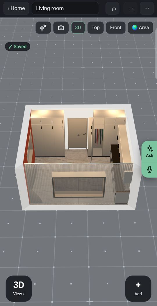
Lights
Add ceiling lights, lamps and LED strips and see where you need them after the sun goes down.
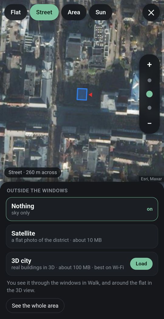
Your flat in its city
Enter your address and the street and buildings around you appear in 3D, wherever the map has them.
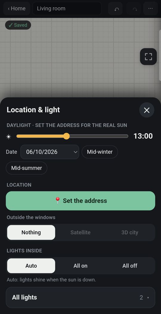
Sun for your address
Real sunlight by date and hour, and how long each room gets direct sun.
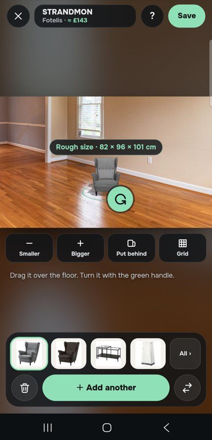
One piece, in your own room
Through the live camera or in a photo of the room, stand a sofa on your own floor at its true size.
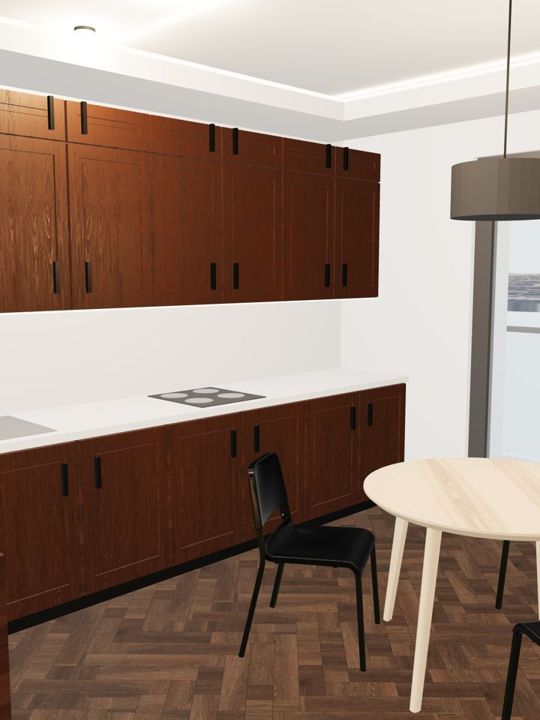
Detail
Window and door types, kitchens, wardrobes and bathrooms built piece by piece.
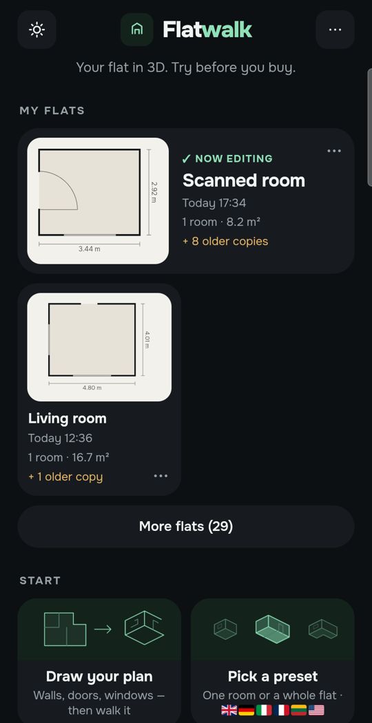
Made for a thumb
Slide the hour with one finger and watch the light move through the rooms.
Swipe for more. Every picture is the app itself.
One flat, free
Most people plan one home. For that, Flatwalk costs nothing: no time-limited trial and no card needed. Drawing the flat, the sun for its address, lights, furniture and walking through it are all part of it, and each AI tool comes with one free try. A membership is for people who want more flats or more AI.
Questions people ask
Is SunCalc free? Yes. SunCalc is free to use on the web; donations are optional.
What is the difference between ShadeMap and Shadowmap? They are different products. ShadeMap (shademap.app) paints the shadows of buildings, trees and terrain over a map. Shadowmap (shadowmap.org) shows sun and shadow on a 3D city, free for today's date, with paid plans for any date, home features and solar analysis.
Is Shadowmap free? Partly. The free plan shows the sun path and the current day with 3D buildings and terrain. Choosing any date starts with the Explorer plan, 2.50 a month billed yearly, as shown on its pricing page on 22 October 2026.
Does ShadeMap show trees? Its home page says it simulates shadows cast by buildings, trees and terrain in 3D.
Which tool shows how many hours of sun my window gets? Flatwalk's free sun tool: give the address, your floor and the window, and it shows the hours of direct sun by day and by month, with what blocks it.
Flatwalk puts the real sun for your address into a 3D plan of your flat, by date and hour, free for one flat. It is coming soon to Google Play; join the waiting list at flatwalk.app.
Join the waiting list